


GeoView Lite app for iPhone and iPad
Developer: EZStuff Software Inc.
First release : 08 Jul 2013
App size: 276.39 Mb
Portable mapping software for the great outdoors!
GeoView Lite is a geospatial image viewing application designed for outdoor enthusiasts and professionals. Use it to create a layered display of Apple, ArcGIS™ or Mapbox™ maps, raster graphics, vector graphics and your current GPS position. You choose the files, we sort out the details. Everything has logical default settings to get your data displayed as quickly as possible. You may, of course, choose to customize the workspace to suit your own taste, but in most cases you won’t have to. When you have things the way you like them, you can save the workspace for quick loading in the future.
FEATURES
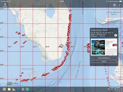
• overlay Apple Map, ArcGIS™ maps, Mapbox™ maps and other basemap sources, GPX, KML/KMZ & your GPS position
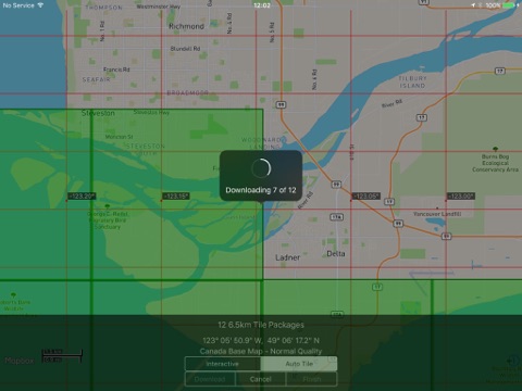
• download basemaps from a variety of sources for offline use
• use Geospatial PDF and GeoTiff for base maps (can be used offline) (*)
• use geoJSON and geoRSS vector overlays (*)
• add & edit placemarks, routes and tracks with user-selectable symbols, names & descriptions; save them as KMZ
• assign custom speed units to routes for better completion time estimates
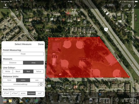
• elevation profiling of routes and tracks
• split your data into layers with custom attributes for data entry and display(*)
• import features, layers and data attributes from supported vector graphics file types (*)
• post place marks, routes, or GPS tracks on popular social media
• share your GPS and cursor locations using social media
• geo-referencing using embedded data, World Files, or manual entry
• projection of vector data and GPS to the base map spacial reference system
• in-app purchases for many file formats and other layer types
• file management and distribution using Dropbox, iCloud, AirDrop, and HTML
NOTE: (*)Some features are only available with in-app purchases.
Requirements: Compatible with iPhone, iPad & iPad mini running IOS 11.0 or later. Requires an Internet connection for Apple, ArcGIS™ and Mapbox™ maps (offline maps can be downloaded) and web services. For GPS location information on iPads, device models with 3G are required.
Note: Continued use of GPS running in the background can dramatically decrease battery life.